In a recent column we discussed the use of the web soil survey as an integral part of the preliminary site evaluation. Again, the web soil survey address is as follows: websoilsurvey.sc.egov.usda.gov/app/homepage.htm.
We encourage you to explore this site and become familiar with the available information on soils in your area. The site is useful whether you are dealing with problem soils such as those high in sodium content, or more suitable soils for installation of systems. Looking at the map unit descriptions gives insights into how soils may change across your site based on landscape characteristics. The series descriptions and soil profile descriptions shed light on soil morphology features to look for when soil pits are opened during the field phase of a site evaluation.
At this point it’s important to point out information contained in the web soil survey was gathered at large scale; roughly a boring or two every 3-5 acres, with assumptions made about continuity based on landscape position, vegetative growth and appearance at the surface. It was not intended to be used in place of an actual onsite soil evaluation. Rather, it is a guide for what to look for when you are on the site.
HIGH SODIUM SOILS
Determining the use of soils in high sodium content is an example. From the web soil survey, you learn pH can be an indicator of sodium-caused problems. If the pH is above 8.0, you will likely see problems with permeability. A handheld pH meter or pH color strips can be used in the field to test the condition in your soil pit.
From the series descriptions it can be learned that soils high in sodium have prismatic, or columnar structure, in the subsoils on these sites. If you see this structure in the pit you are evaluating, it should immediately suggest a problem. Other soil characteristics to look for are dark black soil peds that are shiny on the surface. Some may have visible, small white crystals; these can be an indication of sodic soil. In addition, sodic soils may have a soapy feel when moistened and textured.
Once the problem is identified during the field evaluation, the focus turns to using this information to provide some design guidance or — if you are the site evaluator and designer — to determine what you are going to do relative to this specific site. This is true for any soil condition, not just problem soils.
The first recommendation is to avoid that site if possible. In other words, look for a more suitable site on the lot. This is where map unit descriptions can help by indicating the kinds of inclusions or other soils that may be present in the area. If that is not feasible, try to locate the system in an area with the best surface drainage available. Sodic soils are subject to becoming waterlogged, so it is important water can move away from the system.
Another note here: It becomes even more important in this situation that surface water be diverted from the system. It may also be helpful to install a combination berm and curtain drain around the system.
SPREAD THE FLOW
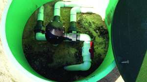
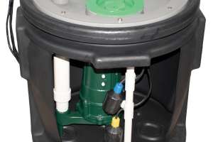
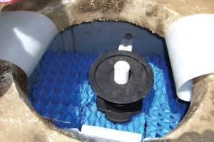
Due to the very slow permeability, the goal in terms of the soil treatment and dispersal unit should be to spread the flow out as evenly as possible over the infiltration area. The two best kinds of soil treatment units to do this are sewage treatment mounds or drip irrigation. There should be no excavation of the soil. The soil surface should be used as the infiltrative surface. The surface should be prepared as for any mound installation with the surface scarified and vegetation removed.
For a mound system, the design should start with a minimum elevation in the clean sand 2 feet above the soil surface. This means the mound will be 4.5 feet tall where crowned at the top and 4 feet at the upper sidewall of the infiltration bed. Application of effluent in the infiltration bed should be through a pressure distribution network. Similarly, drip irrigation can be installed in an elevated sand bed a minimum of 2 feet above the soil surface. Both meet the goal of applying effluent over the entire soil treatment area during the day. Salt tolerant grasses or vegetation should be established over the site upon completion.
One additional important piece of information is needed. For sodium affected soils or soils with high shrink-swell characteristics, the soil sizing factor to determine the infiltrative area needed to accept the effluent should be in the range of 0.12 gpd per square foot to 0.2 gpd per square foot. This means the absorption area needed beneath the mound or elevated sand will be between 3,000 and 5,000 square feet for a four-bedroom house and an estimated daily sewage flow of 600 gpd. How the system area is configured will depend on other site characteristics such as slope.
From this example, we hope you can see soil survey information can be used to inform and direct the in-field part of a site evaluation and can be used to establish design parameters when the knowledge is applied in the field.
Continue reading for free