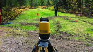
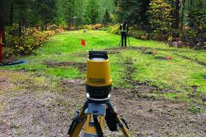
Land surveying is a pretty black-and-white business. At its simplest definition, a land surveyor’s job is to locate the precise line that marks where one property ends and another begins. That line is a legal description of a property, and it dictates how a property owner can proceed with improvements such as installing or upgrading an onsite septic system.
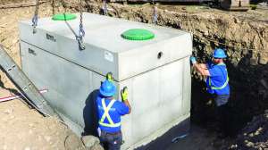
So what happens when a line is lost over time? When an owner assumes that a line runs from “that maple tree to that boulder?” What happens when property improvements, such as a building, driveway or septic tank end up several feet over a line?
The short answer is: a mess.
Ask any land surveyor about the importance of property boundaries, and you’ll get the same answer: “When in doubt, get it surveyed.”
GIS mapping
Geographical Information Systems are a pretty handy way to see general property lines and track down property information, such as tax records and ownership. The software, which can contain satellite images and aerial photography overlaid with parcel numbers and property information, is a fantastic way to look at maps and extract information from data-rich images. But is it accurate enough for onsite installations?
“GIS systems are not a replacement for a survey, and they are not a replacement for a title policy,” says Michael Romportl, the county surveyor in Oneida County, Wis. “When it comes to putting in improvements, we always recommend a survey. GIS is a good guide to start, but it certainly isn’t a replacement for getting a survey on a ground. It’s dangerous, actually.”
Jerry Pillath, a surveyor and assessor in Beaver, Wis., puts it in more simple terms. “Technically, GIS means ‘Geographic Information System.’ But ask a surveyor, and they will tell you GIS means, ‘Get it surveyed.’”
GIS system accuracy can vary by county because the information is only as accurate as the person entering data into the system. In some counties, you might find a system that’s accurate within five to 10 feet of a property line. But even that isn’t enough for compliance when you’re talking about property improvements.
Rob Kamps, owner of Rob Kamps Surveying in Crivitz, Wis., echoes the advice.
“GIS gives some good guidance, but it’s only as good as the guy clicking the items,” he says.
Over the line
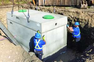
Improvements, including new septic tanks and drainfield replacements, that end up over a property line become a living nightmare for property owners. In a perfect situation, where the neighbors are friendly, an onsite system encroachment can sometimes be resolved with an easement that exists for the life of the system. Kamps says he has been involved with several resolutions like that, but sometimes, the answer isn’t as easy.
“How it’s usually solved is the people who are encroached upon say, ‘Get it off my property,’” he says.
And that’s when things get more difficult and costs can escalate.
Another option for resolution is an exchange of slivers of property between the two owners. This solution, however, is marked with its own problems, especially when one of the properties is under a mortgage.
“It’s not as easy as just swapping properties,” says Romportl, who has dealt with a drainfield that extended into a neighboring property. “You have to get a release from a mortgage company, which can take a lot of effort.”
In a worst-case scenario, a septic system encroachment can go all the way to court.
“Encroachments run the gamut of problems when someone tries to save a few pennies by not getting a survey,” Romportl says.
A penny saved
Kamps admits that septic encroachment problems have become less frequent in the past decade because builders are more cautious and will only make improvements when the property line is professionally marked. And he reminds everyone who asks that a survey, which averages less than $1,000 for a simple lot without a flood plain, is cheaper and easier than wrestling with the problems of a property-line encroachment.
“The survey part is simple,” Kamps says.
Whenever a property boundary is in question, your best bet is to encourage property owners to invest in a professional land survey. GIS systems are not a do-it-yourself survey, and they can bring expensive repercussions if used incorrectly. Despite the technology and information that’s available across the Internet, there’s no replacement for a good, old-fashioned land survey from a registered surveyor.
Bottom line: Get it surveyed.

How do you deal with property boundary issues when installing new onsite systems? Post a comment below.
Continue reading for free